
North Base is SamTrans’ primary hub for vehicle maintenance, operations, and dispatch, playing a central role in the agency’s daily transportation services. The 27-acre property houses two-thirds of the SamTrans bus fleet, an operator training facility, and rest areas for bus operators and other essential staff. It is also the planned site of a hydrogen refueling station for SamTrans’ new zero-emissions fleet.
Fact sheet Hoja informativa 情况介绍
Did you know that San Mateo County faces a greater threat from sea level rise than any other California county?*
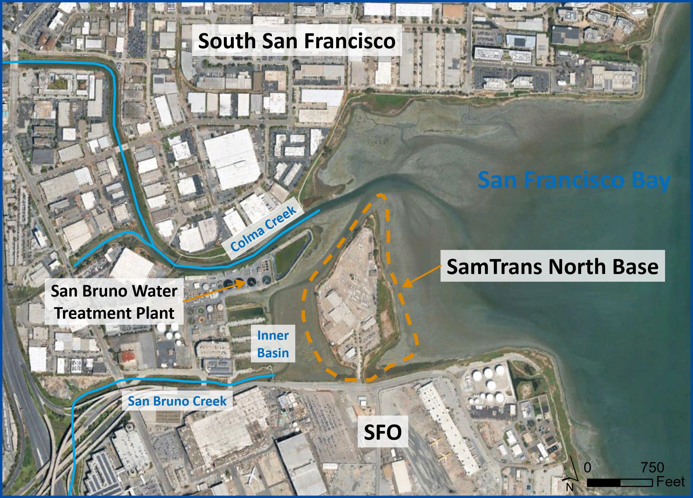
Over 40 percent of its land, which encompasses bayside communities, critical infrastructure, and large parts of the population, is at risk. North Base is highly vulnerable to sea level rise and severe storms due to its location in the San Francisco Bay, where Colma Creek and the San Bruno Creek flow into the Bay.
As sea levels continue to rise, storm surges in the San Francisco Bay will grow in intensity and have the potential to be more costly for SamTrans. SamTrans needs to plan ahead in order to protect its fleet and operations to ensure it can continue to provide the transit service that millions depend on every year, preserving our regional economy and community in the process.
*Information from OneShoreline, a San Mateo County agency that addresses flooding, sea level rise, and coastal erosion.
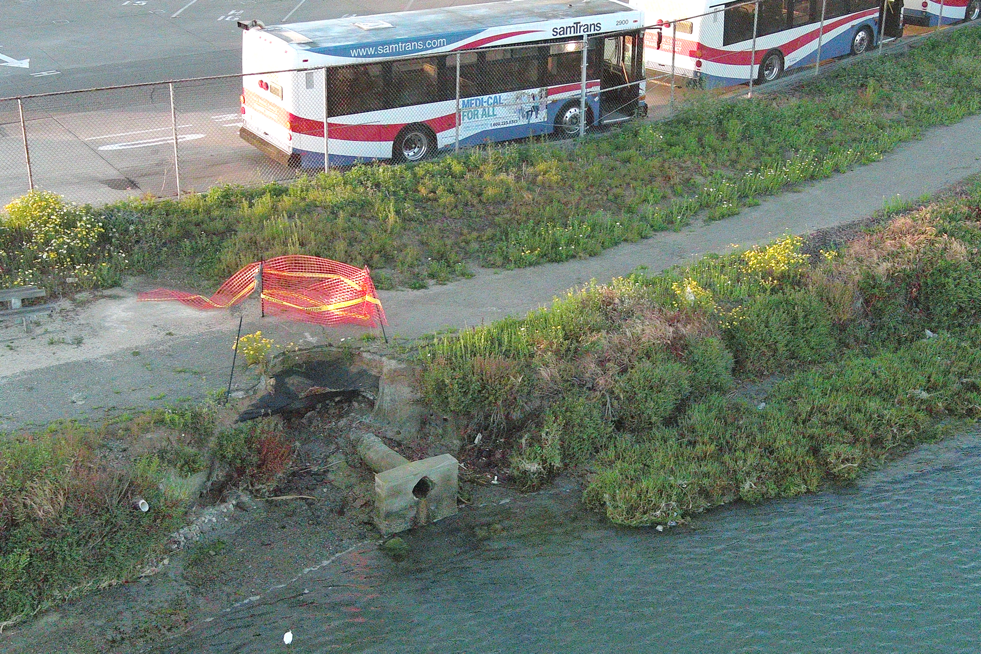
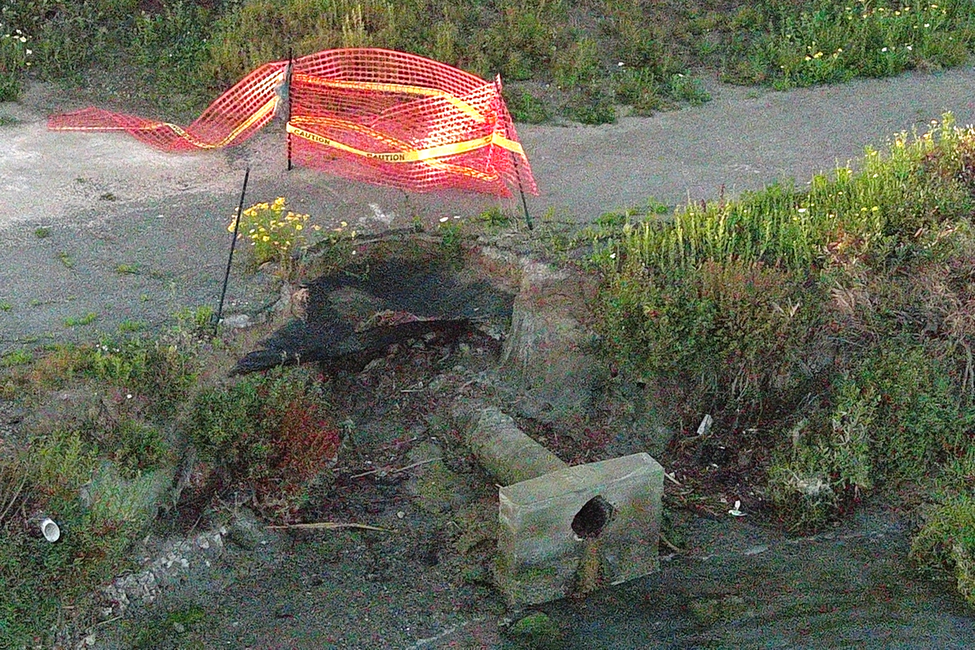
Parts of the property are already impacted by shoreline erosion and soil movement (shown above).
To address these risks and maintain its ability to serve the community, SamTrans conducted a feasibility study to explore two potential flood protection solutions: Regional Protection, which would safeguard North Base along with some adjacent communities, and Perimeter Protection, which would provide protection around the perimeter of North Base.
There’s More Riding on Transit Than People
Access to North Base is imperative for SamTrans to provide reliable and efficient transit to San Mateo County communities, supporting the region’s economy, workers, and educational institutions. SamTrans serves 9 million riders annually, including frontline workers, service providers, and students. These individuals are critical to the health of the regional economy.
Protecting Community Resources
North Base is home to the beloved San Francisco Bay Trail, which is used by the public for recreational activities and the chance to catch a glimpse of local wildlife. The property is also the site of one of San Mateo County’s largest housing shelters, Samaritan House’s Safe Harbor Shelter, which provides emergency and short-term housing to more than 350 people annually. Protecting North Base will ensure it remains safe and accessible to the entire community.
Flood Protection Options
To protect North Base from flooding and erosion caused by sea level rise and severe weather, SamTrans conducted an extensive feasibility study which resulted in two long-term options.
Alternative 1 – Regional Protection would provide protection to the North Base facility and has the potential to protect parts of South San Francisco, Colma, and San Bruno Creeks that are also at risk.
Alternative 2 – Perimeter Protection would solely provide protection around the perimeter of the North Base peninsula.
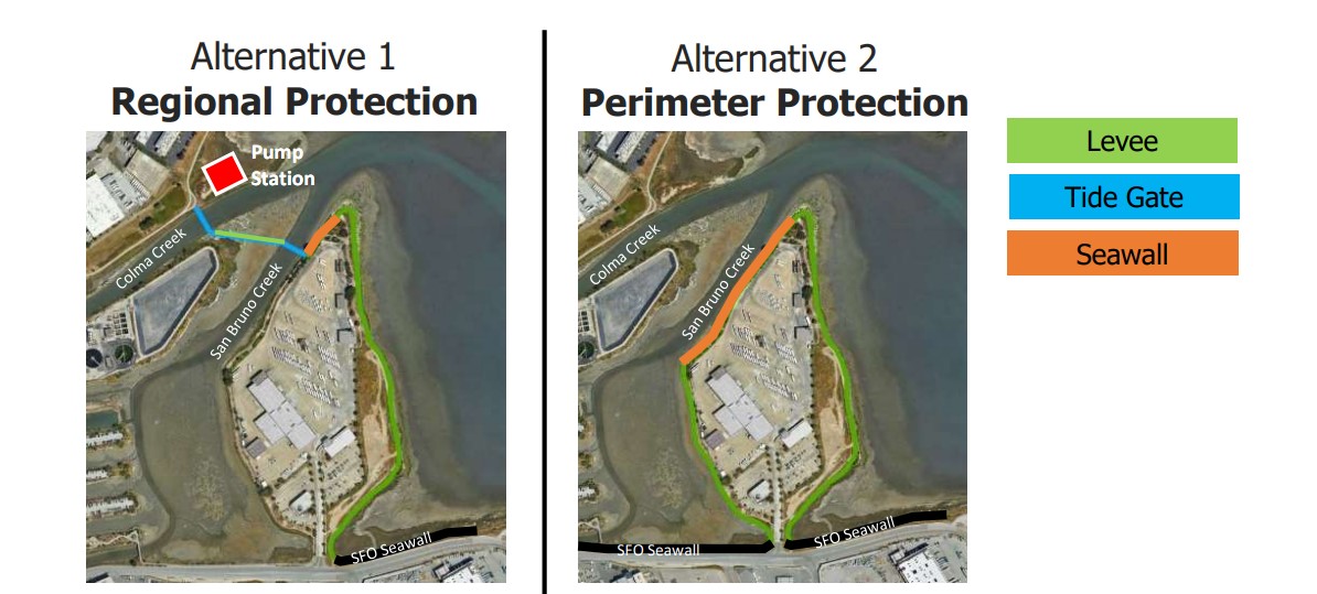
Each alternative includes a combination of three possible protection options:
- Levee: A levee is a sloped embankment built to prevent river and coastal overflow, flooding, and erosion.
- Seawall: A seawall is a physical structure designed to protect coastal areas from waves, storm surges, flooding, and erosion.
- Tide Gates: Tide gates are hinged doors installed in tidal zones that help maintain drainage, control flooding, and reduce erosion by managing water movement.
SamTrans evaluated both alternatives to understand the benefits, impacts, costs, and implementation timeline for each option.
Resources
- Fact Sheet
- Hoja informativa
- 情况介绍
- FAQ
- Preguntas más frecuentes
- 常问问题
- June 2025, SamTrans Board of Directors meeting
Project Process and Timeline
The study started in March 2024 when SamTrans began collecting data and determining criteria for engineering, environmental impact, and permitting. Conceptual designs were developed, and from December 2024 to March 2025, SamTrans engaged with permitting agencies and potential beneficiaries, exploring opportunities for collaboration and cost-sharing.
In June 2025, the SamTrans Board of Directors received results of the study and staff's recommendation to further explore Alternative 2: Perimeter Protection Solution.
The United States Army Corps of Engineers (USACE), San Francisco Bay Conservation and Development Commission (BCDC), and the San Francisco Regional Water Quality Control Board (RWQCB) will also review and approve the solution, ensuring safety and benefits for surrounding communities and the environment.
Following the Board's acceptance and approval of the study results, SamTrans is considering funding and implementation strategies.
